From Darwin to Townsville the skies are anxiously being scanned by the populace seeking signs that a heavy Wet is on the way .While there have been short duration electrical storms , the intertropical front bringing much needed drenching rain has not checked in .
Just when the weather chart looked like the monsoons were sweeping towards Darwin , near Christmas, after a torrid build up, the moisture was sucked down the West Australia coast and formed a cyclone.
Sky watchers across North Australia , intent on dancing in the rain when the heavens open , should the Wet arrive , sent the following photographs. The first , from Darwin, where several weeks ago a slightly troppo correspondent sighted a gleaming white cloud shaped like the head of a parched ship of the desert , a camel , with lips extended , came the tantalising snap of a run of the mill storm over the harbour. Not a once in a hundred years deluge, which would be much appreciated by many crazed Darwinians .
 |
As dry as a nun's nasty - Robert Wesley-Smith's manmade lake at Howard Springs...he sitting on the landing , dangling his feet in the non-existent water .
|
CAIRNS REGION
The skies above North Queensland, though dramatic , have not unleashed widespread torrential rain. The weather-wise Pelicans in Cairns , below, report little sign of heavy rain on the horizon .
The following photograph was taken over canefields south of Cairns.
STORM CHASER NEAR INGHAM
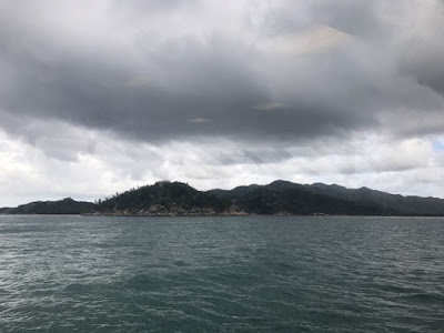
TOWNSVILLE , MAGNETIC ISLAND
 |
View from The Strand, Townsville .
|
 |
Dry Magnetic Island .
|
With Townsville and the island on water restrictions , the city's dam level so low it is starting to look like the bottom of a cockey's cage , prayers have even been offered for a bumper Wet season by a priest and the Townsville City Council . A few electrical storms brought some slight rain ,which resulted in flying ants emerging in droves on Magnetic Island, providing choice food for birds and lizards .


